
Arkona – Stonehenge – The Pyramid of Cheops, i.e. a few uncommonly bizarre maps – Slavs, Vikings, Scyths
©® by Czesław Białczyński
© translated by Katarzyna Goliszek
Today, instead of a lengthy article with explanations, I will provide you with a few bizarre maps from which something may result or not. Their oddity is that they show specific straight lines joining distinctive points of Earth. These are the lines that run over long distances and as a matter of fact, cross the spots that are significant to the Faith of Nature and the spots of their peculiar character (as, for instance, the Pyramid of Cheops), or specific geographical points.
[Click- magnify]
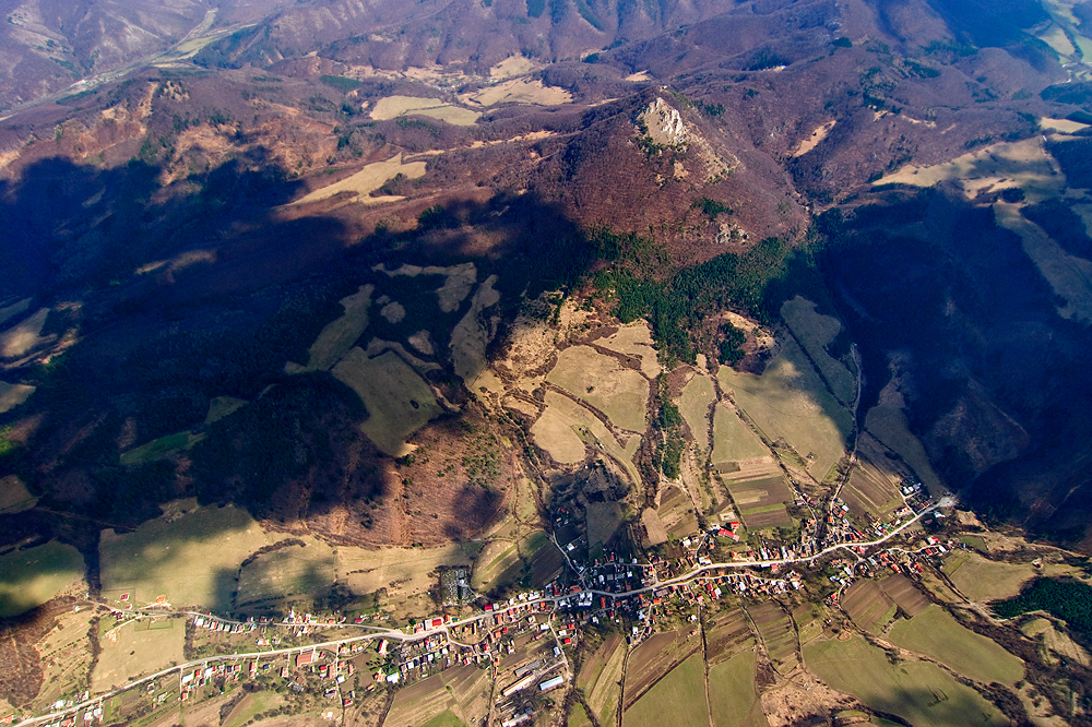
Here is the first of them – the oldest possible plan – so called Barbaricum – the area which – according to history school books used by teachers in primary, lower secondary and high schools today – was not reached by ancient civilisation. Megaliths had been before ancient civilisation. The ancient times are understood differentially, however. When I attended primary school in 1960, the idea of cities-states in Sumer was hard to comprehend by educated people. The ancient period was understood as the times of the Roman Empire, Greece, or Egypt. Practically, there was hardly any mention about China in school books. According to the school books, there was probably nothing north of Caucasus and the Danube, and megaliths were presumed to be prehistoric times – the Stone Age. The physical existence of the mythical Troy was still questioned then. Nowadays, we consider these and other issues differently, including chronology and civilsational status – let us say, the culture of the Scyths. For example, Arkaim in Ural is the structure that has existed for the same time or even longer than Troy. Let us have a look at the first of the quaint maps and the first mysterious line.
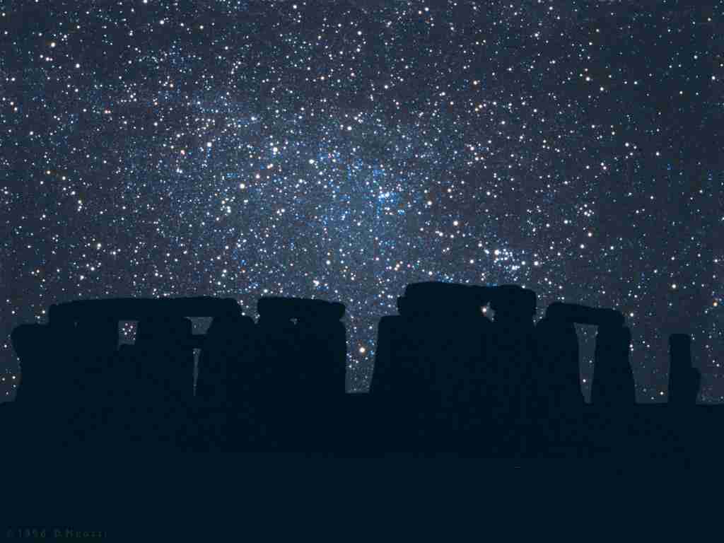
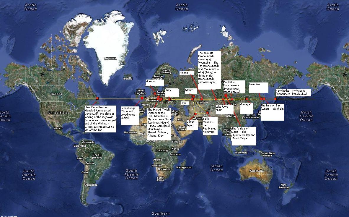
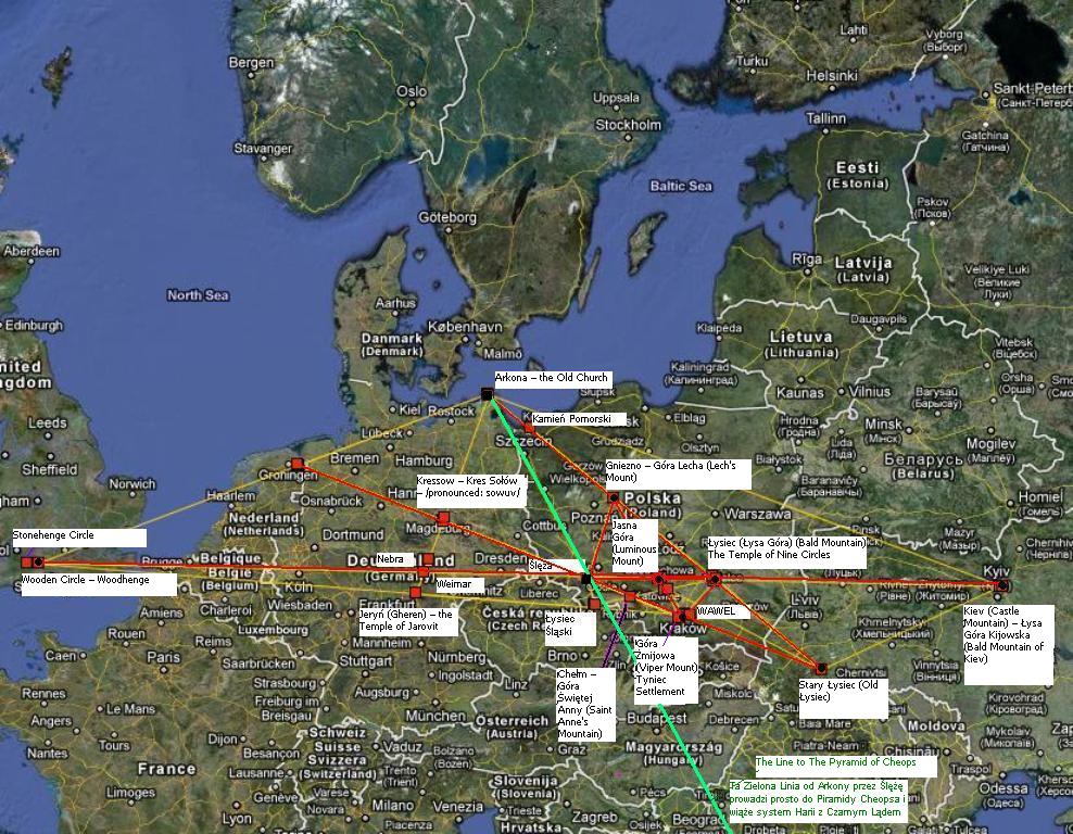
The Line Circle Stonehenge – Kamchatka – Newfoundland
The straight line joining Stonehenge with Kamchatka – (its very headland) is 8486 kilometres long. On or near it, not farther than +/- 50-100 km, there are a number of significant or very significant mounts and hills regarded as holy by the Faith of Nature in the past, or recognised as archeological civilisational monuments. It is noticeable that the deflection from the line of 9000 km at approximately +/- 30-70 km can be compared to the deflection at the length of 90 km at 300 – 700 metres, and at the length of 9 km to the deflection of 30 – 70 metres. It is an absolutely astonishing precision for someone who does not have either a theodolite or GPS. There is a distance of 700 km between Łysa Góra and Kiev and the deflection is about 12 km. It is comparable with a deflection of 1200 metres from the line at the distance of 70 km and a deflection from the line of 120 km at the distance of 7 km. What must be also taken into account is the necessity of moving on the line from one altitude point to another – seen from the distance and not among any insignificant bulges of the area. Considering this, various minor side deflections should not undermine the fact that the line is practically straight at the distance of a few to several thousand kilometres. When we pull the line to Newfoundland, then it is 3600 km longer so even a 150–kilometre deflection from it – as it is, for instance, in the case of Arkaim is minor, particularly on such desolation as Siberia and Ural.
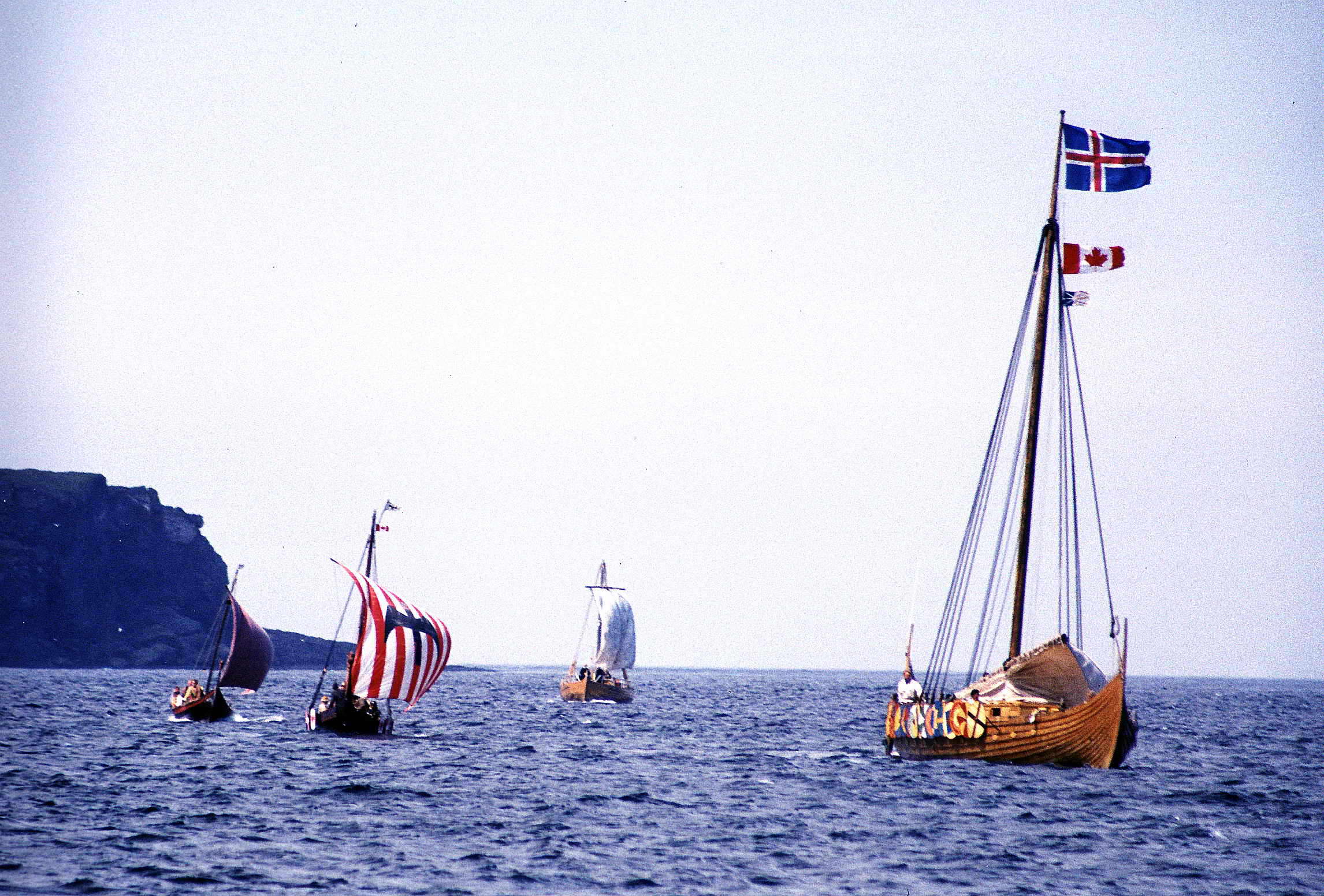
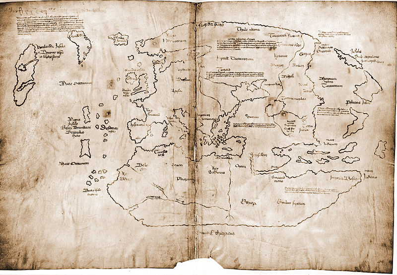
This lenghtened line across the Atlantic Ocean to America somehow strangely goes through Newfoundland in Canada – the place of the historic landing of the Vikings in North America in the IX-X th century AD, identified by archeology. The place is called L’Anse aux Meadows and is situated (depending on interpretation) from 10 – 50 km north of the Line. The settlement and Newfoundland are associated with the legendary Winland of the Vikings and their journeys from about the year 1000 . The settlement dates from 1000. Yet Winląd /pronounced: vinlowd/, according to medieval maps is Buffin Island (as the map drawing of the island is read), so Newfoundland is not Winląd but something totally different.
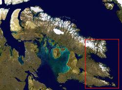
Furthermore, it can be easily noticed that local names scattered all over Europe and Asia which own their win- wene– elements are mostly associated with Veneti-Venedi, the peoples of the Lusatian culture so with Wędowie /pronounced: Vewdovye/ of the Mythology of Slavic people. Thence this may be much older history from the period of the Lusatian culture if not earlier (the Trzciniec culture). Well, we may suppose that ”verbal memory” of the generations dates back further than the found material traces coming from the X th century AD. In North America there are traces as well as found human skeletons dating from even 19.000 year BC. Anyway, one can surely say that people from ancient Asia and Europe travelled to North America and settled there – the furthest about 14.000 years ago.
Buffin Island
As we know, Scoloti-Slavic (R1a1) blood and Old European (I1 and I2) blood run in Scandinavian people so they may transfer legends and stories about taking Weneląd /pronounced: venelowd/ from the past of the Trzciniec and the Lusatian cultures to the Middle Ages. The whole world known to the peoples of the North consisted of Three Lands then – Wąda Land /pronunced: vowda/ (Węda /pronounced: vewda/ – America), Lęda Land /pronounced: lewda/ (White and Black which means Europe and Africa) and Mazia Land (Mazia-Tetyda-Tiamat which means Asia) which is reflected in the simplified name today – Atlantyda (Wąd-Ląd-Tyda) /pronounced: Vowd-lowd-tyda).
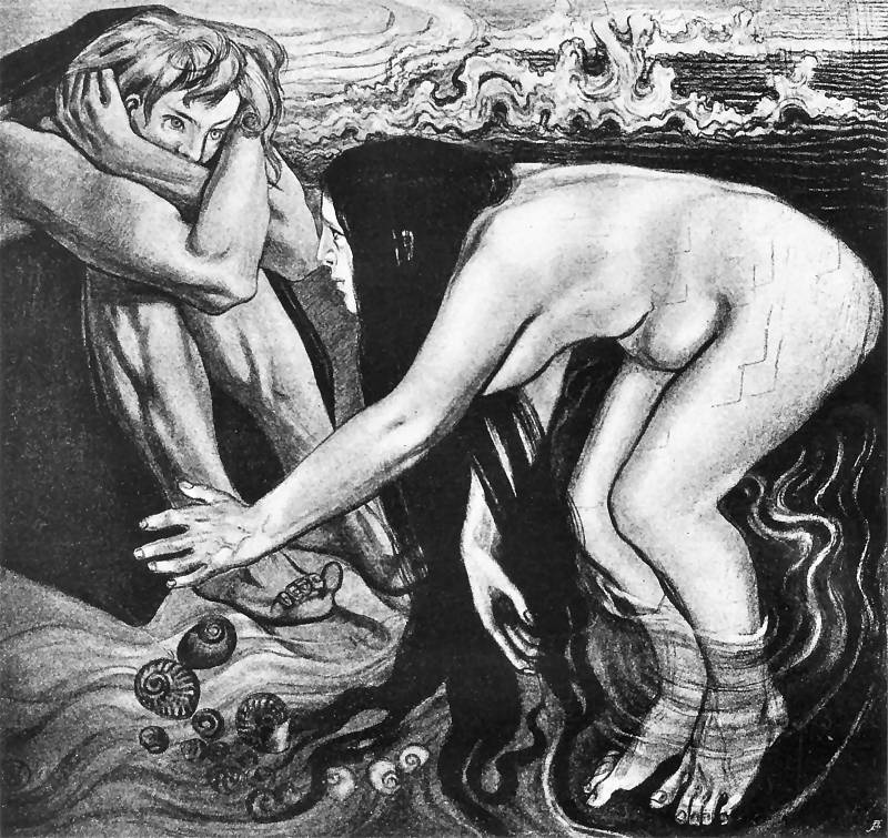
Tethis and Achilles – by Stanisław Wyspiański
Tethys (in Greek: Θέτις Thétis, in Latin: Thetis) – Nereida in Greek Mythology, was said to have been Nereus and Doris’s daughter and Peleus’s wife, and Achilles’s mother. She was brought up by Hera. The prophecy said that she would give birth to a son who would be stronger than his father, which calmed the enthusiasm of such gods as Zeus or Poseidon for the beautiful goddess. She married Peleus who was mortal. When she gave birth to Achilles, she attempted to make her son immortal so she dipped him in the Styx but as she was holding him by the foot she left the only weak spot. Peleus was against Tethys’s acting. As a result, Tethys broke up their marriage and she and Achilles left home.
[We interprete this character differently – as Amazonka Maza-Maża-Mazja – auntie (in Polish: ciotka – tetka and Tma – Ćma-Ciemnia-Tiamat, Tyia) – an earthly incarnation of the Ruler of the Land of Silence (silence in Polish means cisza) so Nawia /pronounced: navya/, Nicość (nothing, oblivion), Węda and Lęda’s sister /pronounced: vewda and lewda/ which means the incarnation of the goddess Tya-Nyja /pronounced: nyia/ in the same way as those two were the incarnations of Wąda-Woda /prounced: vowda, voda/ and Łada-Łagoda /pronounced: wada, wagoda/. Tya-Nyja (T’ma-Ćma) is called Tiamat – Tiamat’ in the Mythology of Persians. Tiamat’ – Ciemność is the goddess of the underworld and afterlife who became the nymph of the Black Sea for the Greeks – and that sea is the Sea of the Dead. Tiamat’-Ciemność-Tya-Nyja is also Asia-Mazia’s mother, the Queen of Euphrates-Nieuwrat – the irretrievable river, the Tigris (in Slavic languages: nieuwrat /prounced: nyeuvrat/ means the one that does not return, the one that does not retrieve.
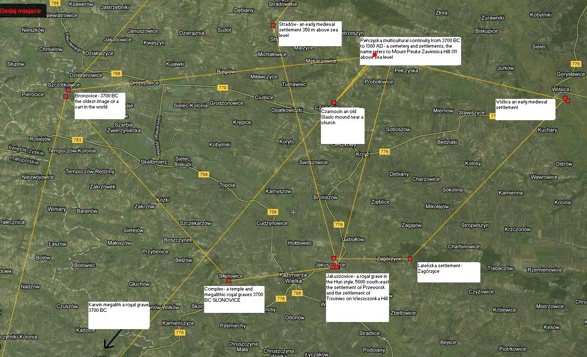
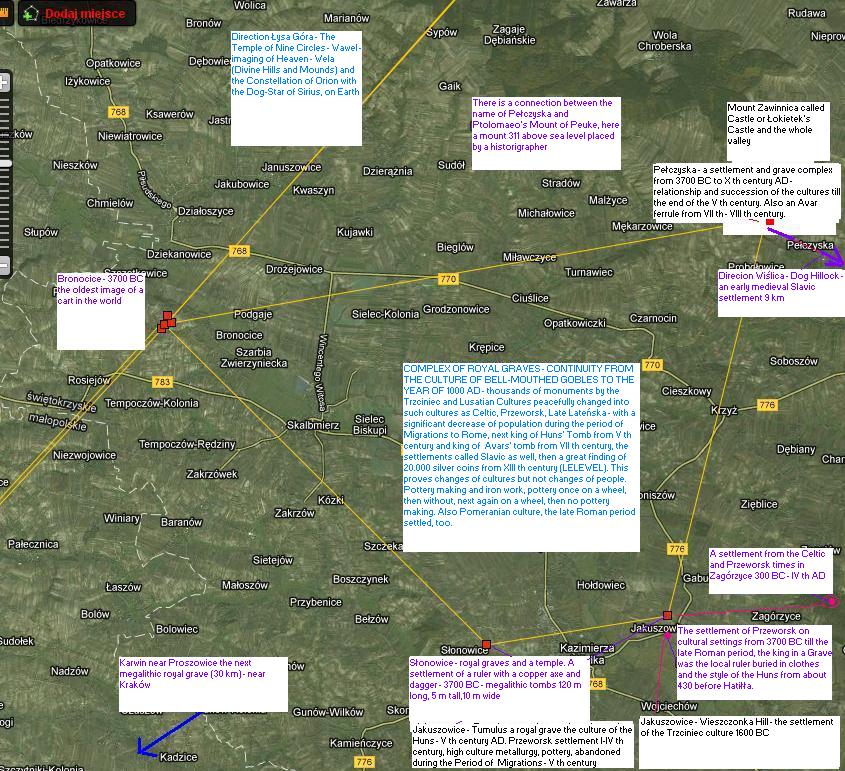
We associate the name Peleus – Pałajusz /pronounced: pawayush/ with Mount Pałki /prounced: pawky/ and the Pałkins’ tribe /pronounced: pawkins/ (Pałkins from Mount Peuke) and with settlements as well as Royal graves from the period of 3700 – 1400 BC near the places of Pełczyska /pronounced: pewchyska/ and Słonowice /pronounced: Swonovyce) as well as Bronocice – i.e. with so called the Mount Łysa Complex of Royal Graves and Łysogóry (Łysko-Góry – Święto-Góry ) (the Łysko Mountains = Holy Mountains) C.B.]
This line goes through a number of other, very significant places with their worship, legendary and prehistoric-historic meaning. It is just a few kilometres north off this line that Nebra is situated. The famous Nebra sky disk with the images of the Sun, the Moon, Pleiads and other stars was excavated there. It is the oldest equalising calendar of the solar and lunar cycles (1600 BC). The copper that the disk was made of comes from Austeria and the gold from the Carpathians. What is more, the line goes through the main axis of the Harski (Polish) System of the Holy Mountains: Ślęża – Jasna Góra (Mount Luminous) – Łysa Góra (Bald Mountain). Another important thing is that the famous vase with the image of a cart which is the oldest in the world was excavated in Bronocice, several kilometres from this line and near the line there is a Complex of Royal Graves, which we will come back to. Furthermore, the line goes through Łysa Góra in Kiev, and more precisely – again the line runs just a few kilometres from Łysa Góra and from Perynia, exactly through the place called Vyshhorod. The Slavic nations often called the oldest parts of settlements established in a given place Vyshhorods like, for example, in Prague because they were built on tops.
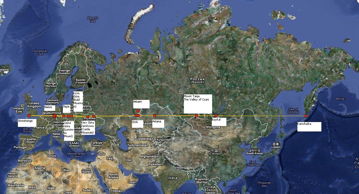
Next, this line practically goes through Arkaim – the deflection is really minor taking such a huge distance into consideration. Arkaim is the prehistoric city discovered at the end of the XX th century in the southern slopes of the Stone Mountains (of Ural), and earlier it goes through Murom Mountain and the sacred spot Kulma that lies about 1800 metres from Mount Murom, and next just behind the sacred spot nearly through the known from the Greeks’ records Gelonos-Gleń-Gołuń (the archeological settlement Bielsk).
Moreover, the line goes to the Golden Mountains (Góry Złote – Załtaje-Ałtaj) running several kilometres from the Valley of the Czars. Then, it goes exactly through the southern side of Lake Baikal, not mentioning that earlier it goes through the suburbs of Astana – the capital city of Kazachstan.
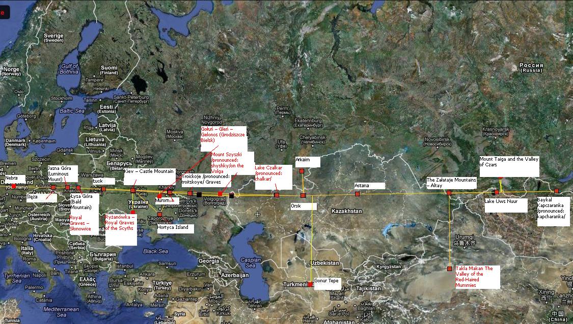
Relatively far from this line lie also interesting spots that I pinpointed here, like Ryżanówka (150 km to the south) known for the famous Scythian Royal Grave, also several hundred kilometres to the south there is Khortytsia Island (300 km) in Ukraine. Very far to the south lies Turkistan and the Valley of The Red-Haired Mummies on the border of China.
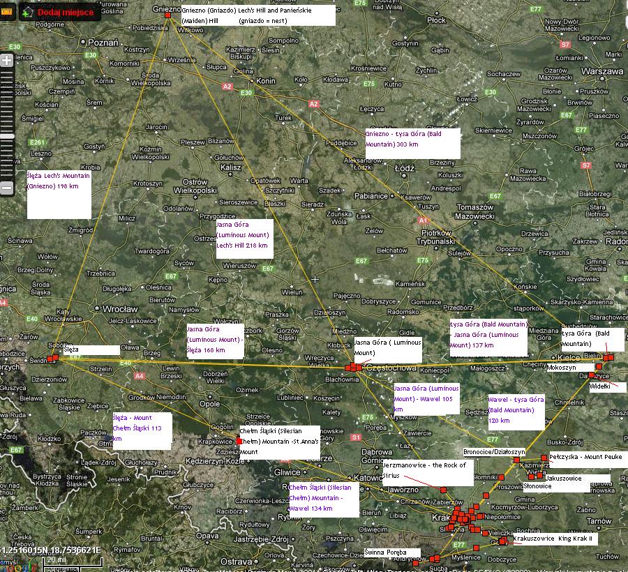
I pinpointed here only the items which come to my mind, without any long or deep studies. It may seem a bit strange to have gathered so many significant places – particularly densely located in Europe. The very fact that the Stonehenge Line – the Headline of Kamchatka that ideally goes through the system of the Polish Holy Mountains appears to be an amazing coincidence – if not something more. I felt more weird when joining the Arkona Peninsula with the Pyramid of Cheops in Wikimap, I crossed Ślęża Mountain again. The Polish System of Holy Mountains and Hills is perfectly entwined into the both lines: the one from the west to the east as well as the one from the north to the south.
The Arkona Line – Ślęża – The Moravian Gate – The Pyramid of Cheops
And now it stops being amusing and funny and it has also ceased to look as a coincidence. However, I still do not exclude simple solutions like the ones that arise on their own, I mean that it is not an accident but, for example, as one of our readers (Artur Wosinek) remarked in his comment – people moved on from one mount to another, they set up settlements on the mounts, they built watchtowres and holy places on the mounts and directed themselves by observing the stars which indicated them itineraries. Nevertheless, it is a fact that acting in this way they created a system of peculiar and outstanding spots. The other truth is that these places are recognised not by people’s merit – Ślęża is the incredibly distinguished mountain. Arkaim is hard to distinguish from its surroundings as there are other well seen and better distinguished mountain peaks than Arkaim which is told about in many quaint stories, fairy tales and legends.
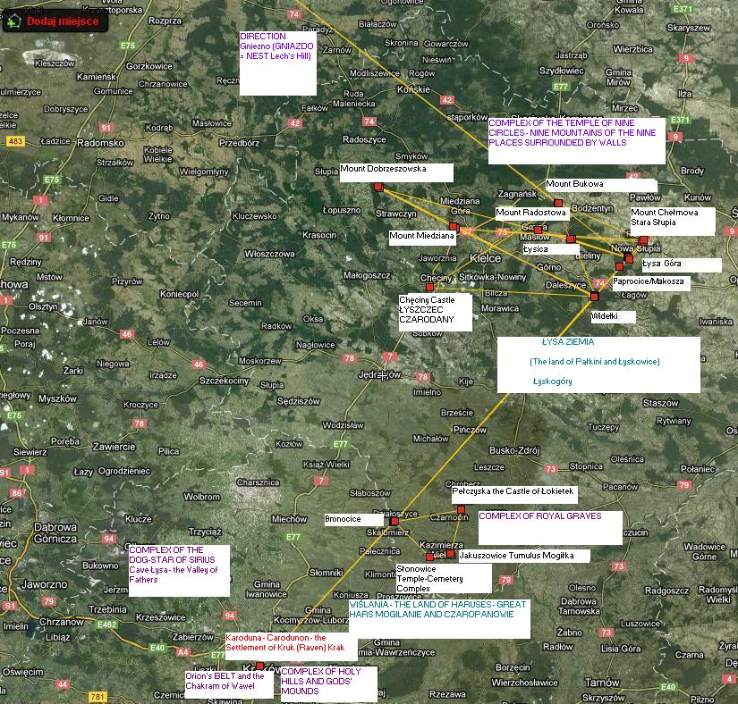
Let us come back to the distinguished places of the Harski-Polish System. As it can be noticed in the picture above, a number of lines make up the internal Polish System which we prefer to call the Harski or Haruski, or Slavic-Irano-Indian System because of its antiquity. The following significant lines go through variable important worship spots not accidently. These considerable spots no other than just Nebra, Weimar and Jeryn (Gheren), such as Kolomyia – Wawel (Krakow) – Chełm Śląski Mountain (the Mountain of Saint Ann) – Ślęża – Kres Sołu Hill (Germany) reach the shore of the Atlantic in the area of Groningen.
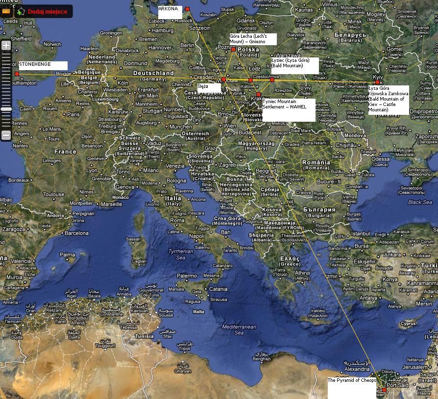
I have no idea about the place near Groningen although I have been there and seen that it is unbelievably flat, just like in Holland. The Dutch may have kept some legends and beliefs about the place but I have not heard about them. The Arkona – the Pyramid of Cheops Line is almost 3100 kilometres, but it is as interesting as the horizontal one to Kamchatka.
We can see the association of the Arkona line with the other lines of the Polish System in the picture above. Here, we can see an important marked line which runs through Krakow and a number of its holy hills such as Wawel or Mount Grodzisko in Tyniec as well as the ones that are less known, namely the Skołczanka sanctuary, or the Hill of Morchołd /pronounced: morhowd/ on the Red Prądnik.
Mount Chełm Łyskowicki from Paprotników-Mokoszy(Paprocice – Mokoszyn)
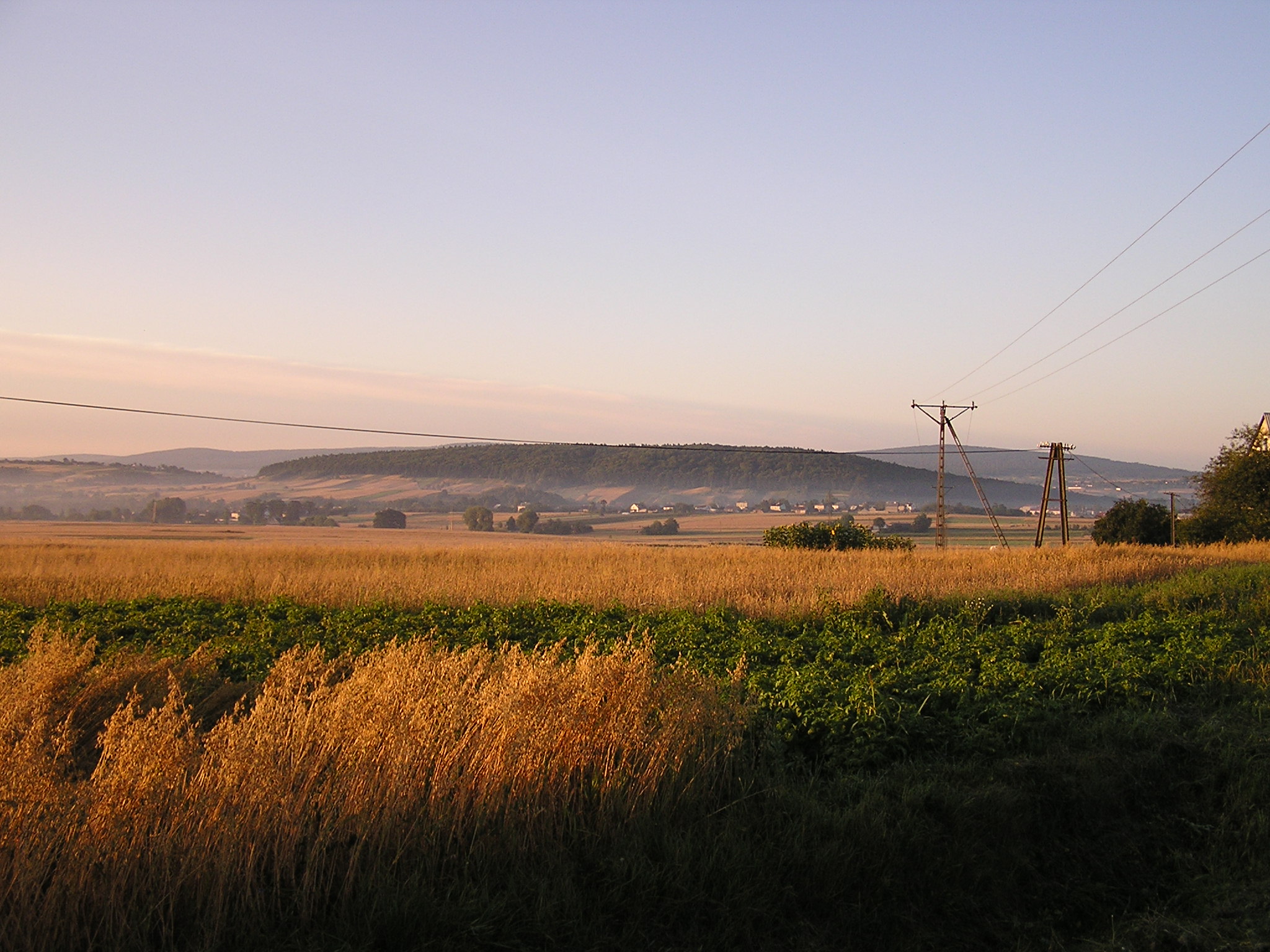
This line links Wawel with Mount Łysa in the Świętokrzyskie Mountains going north from Krakow, among others, through Bronocice (which I hve mentioned above) and through Mokosze Hill or through Widełki to Łysa Mountain, and also a step farther – behind it – to Stara Słupia where it seems to end – on Mount Chełm Łyskowicki. The other end of the line aims at the Arkona the Pyramid of Cheops Line exactly on the very spot where Mount Horna Poruba is situated in Slovakia and the village of Vapec at its foot.
Horna Poruba with Vapec [photo BadE from http://www.vivo.sk
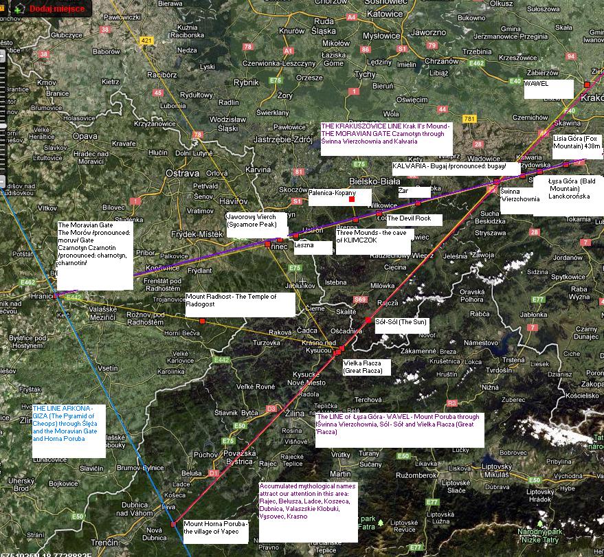
Another shorter line leads to Krak II’s Mound in Krakuszowice not far from Wieliczka through a number of significant hills, also to the Arkona Line – Cheops. The Krakuszowice (Krakuszowicka) Line ends at the Moravian Gate in the village of Czarnotyn. An undoubtedly interesting thing is that we have another Czarnotyn in Małopolska and the Czarnotyn (Czarnocin) there is also a mound. These two lines cross each other on a mount on the planned Świnna Poręba Lake. The mount is called Wierzchownia – this is a Holy Mountain. Krakuszowicka goes through Mount Łysa under Lanckorona and through Mount Bugai, i.e. Kalwaria Zebrzydowska, through the known monastery and its hermitage – this is the line which I called the Line of Three Lakes for it runs along exactly three water reservoirs that started to be at the foot of the holy Mountains: Mount Dobczycka, Mount Świnna Wierzchownia and Mount Żywiecki Żar. It runs farther to the holy place made up of three mountains: Palenica, Kopany – where there is a stone circle and Three Mounds (with a cave).
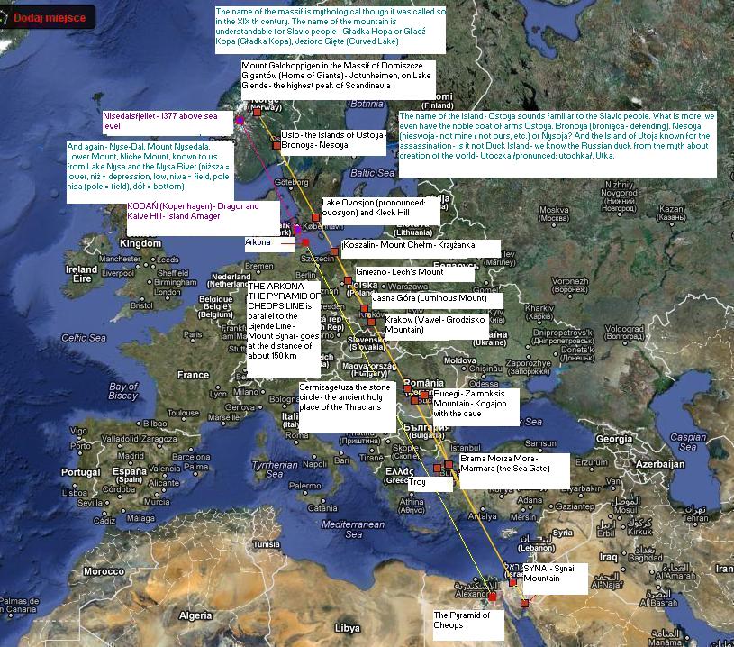
It may seem both interesting and weird that pararelly to the Arkona the Pyramid of Cheops Line goes another line Galdhoppigen – Mount Sinai, through Oslo and Ostoya Island as well as through Ivo Lake in Sweden on the Baltic shore and next through Mount Chełmska and its top Krzyżanka in Koszalin (Grodzie Koszów-Koszanów) and farther through Mount Jasna and Wawel through Sarmacka-Dachska (Dacka – Gącka – Gocka) Sermizagetuza – an ancient holy place with a stone circle, known from the Roman records as the Thracian metropolis. The two lines go paralelly in the distance of 150 kilometres from each other.
The Galdhopiggen Line– Synai is almost 4200 kilometres, i.e half of the length of the Stonehenge – Kamchatka Line. Apart from Sermizegetuza, just a few kilometres east from the mountain there is to be found the famous mountain range – Bucegi. In it there was Mount Żalmokszysza (Zalmoksisa) Mount Kagania – Kaganjąt – Kogajon with the cave in which kings and priests of the Thracians were initiated. It was in that cave that Zalmoksis disappeared for 3 years to be reborn as a holy man (shaman) and the Thracians’ commander. Some people think that the cave and Mount Kagan-Jątu (Kaganatu) is situated somewhere near Sarmizegetuza and its holy stone circle. Then it would lie on the same line. Do you know where the name Sarm-izo-Getuza in the Roman chronicles comes from? Not only was it the capital city of the Getae but also of Sarmatians, Sarmaci iz Getami (-tuza). This itself justifies the existence of something more than a loose relationship between the tribes. Anyway, both the Romans and the Greeks called the areas beyond the Danube the European Sarmatia and east off the Don River they called the Asian Sarmatia, so Sarmatia as well.
One will say that if we drew such lines next to each other sequentially in the distance of 150 kilometres, we would always find on the line a great number of holy mounts and remarkable ancient objects relating to the Faith of Nature and magic places – UNFORTUNATELY IT IS NOT TRUE. Just try to draw them – you will aim direct at the Sahara or at other uninteresting and inignificant places. Surely, if you draw a hundred lines of north-south through Europe with their density of every ten kilometres, they will alwyas go through lots of Christian churches – but not through lots of Pagan Temples of the Faith of Nature. Neither will they go through just a few significant stone circles. There are not so many stone circles lke these in Europe as there seem to be, but they are always in very quaint places which are associated with the main lines presented here.
There is also a very interesting place on the line running through the Holy Mount Chełm in Koszalin and Jasna Góra (Luminous Mount), as well as through Wawel. This place is the Dardanelle Trait where at the gates to the Sea (sea = more, mare) stands the famous Troy, fiercely defended against the Romaiōi people by allied armies of the Scyths. The Troy was not defeated by the Greeks at all. It was ruined by an earthquake and fire according to results of archeological research. But Homer changed that event so beautifully into the Greeks’ trumph.
Smooth Hopa Top – Galdhopiggen
The Galdhoppigen Line – Mount Sinai
[How faltering are Norwegian etymologies of the names Ostoja, Bronnoja, Utoja and others (read 'j’ as 'y’). Till today I have remembered a Russian poem from my childhood about Vitja from Małoj Bronnoj (małoj /pronounced: mawoy) (małoj = small). And the noble Ostoya coat of arms and the family line of Scythian-Sarmatian-Slavic became the brand of one of the best hotels in Krakow. Utoja famous for the assassination – do you know the word utka, utoczka /pronounced: utochka/ – in Russian it means a duck. That was not just any duck, but the mythical Utka duck that carried a bunch of clay in the beak at the beginning of the world, the clay that was reached by Czarnogłów /pronounced: charnogwuv/ from the Depth. Utka – as that was the clay made of (make = roll = utoczyć – utka) the one of Czarnogłów, stolen from him, and Utka because it hid the clay – it hid it in the beak (utkała = hid; utknąć = hide), and finally Utokła – for it ran away (utokła, uciekła = escaped, ran away) from angered Czarnogłów with its prey. The Golden Duck is only disguise for Białoboga who fights against Czarnogłów for ruling over the Earth emerging from the Depth.
In the Polish language this archaic, mythological name – the name of the holy duck has not been kept. Utoki Island – lies near Oslo, and Henryk Ibsen wrote a drama ”Wild Duck”. He borrowed the subject for the title from his fellow-countryman Velhalven ”Sea bird”. The poem tells a story about a duck wounded by a reckless hunter. The duck fell down the sea bottom to die there. As one can see, folklore motifs were used in the same way among Norwegian romantic writers as among Polish writers of that time. Also, near lie three islands: Gęsia (Gaesoja) Island (gęsia <adj.> = duck), grown with forest Borowa (Boroya) Island (borowa <adj.> = forest) as well as Grom (Grimsoya) (grom = thunderclap). The fact that these places belong to a very old settlement dating back to about 1000 years BC is proven by discoveries in Bronnoya. Difficulties of the etymological deduction from the Scandinavian languages which you can see below along with the simplicity of deduction from the Slavic languages prove the common – forgotten today – past of the Slavs and local Old Europeans. Ostoja can be derived in a complicated way first from oset (oset = thistle) – chwast (chwast = weed), and then zboże (zboże = grain) – owies (owies = oat). However, the simplest way is to derive it from stajanie /pronounced: stayanye/ and stanie, bycie (= being) – ostoja. C.B.]
Ostøya
Ostøya is an island in the western section of Oslofjord (Vestfjorden), within the borders of the municipality of Bærum. It is the second largest island in the Oslo basin, after Nesøya. It is adjacent to the municipal border with Asker, where Nesøya and Brønnøya are to its northwest and southwest, respectively. Within Bærum, Borøya is to the north, Kjeholmen to the northeast, and Grimsøya to the east. To the south is Gåsøya.[1]
At some point the island was split in two. The island is named after the farm that is situated on it. The etymology of Oust, or Ost is uncertain. O. Rygh claims the etymology is unknown but that the farm derives its name from the island’s original name. Others speculate that it may have an Old Norse origin related to ouste, in the sense of claiming new land.[1][2]
Brønnøya
Brønnøya
[The number of name possibilities relating to the word bronić (= defend) and brona (= harrow), obrona (= defense) proves a great uncertainty of Norwegian terminology and incomprehensibility of names passed on by verbal tradition, and recorded much later – as late as in the XVI th century].
We will take the names Nysa, Nisza into consideration soon because we will talk about them in the further part.
Lake Ivosjon – Iwo Island and Klecka Hill
Lake Ivösjön, southern Sweden
[Also in this case the etymology is uncertain and hard to justify but, after all, we in Poland perfectly know what such flat islands are characteristic of, the islands that are a bit swampy with a little hill. The hill has the name which sounds familiar to us – Klacka – Kłocko – Kłodzko, like in the word Kłodź. Iwa is nothing but willow wood, even not trees but thicket densly growing in such muds. Does the nearby river Morrum Mor ryg – Mor rzek – Mor -rjeka not sound familiar? CB]
The lake is situated in the Skäne region which is one of the most naturally beautiful in Scandinavia. It lies 20 kilometres off the Baltic coast.
The Morowa /pronounced: morova/ River
W pobliżu leży rzeka łososiowa Mörrum i miasto Mörrum.
Nearby are situated the Mörrum (salmon) River and Mörrum town .
Ivö (ou Ovö) is an island located on the Lake Ivö, the largest one in Scania (SE Sweden).
Historically the province of Scania was a part of Terra Scania (Skåneland in Swedish and Skånelandene in Danish), which together with Jutland and Zealand, the other two Lands of Denmark, formed a Danish state in the 9th century. Scania is separated from both regions by the strait of Sund (Öresund in Swedish, Øresund in Danish).
Following the Treaty of Roskilde in 1658, Scania became a possession of the Swedish Crown.
1 – On the promontory at Ivö Klack, on the northern tip of the island of Ivö, are the remains of china-clay (kaolin) mines worked from the end of the nineteenth century until well into the 1950s. The clay used to be transported by barge across the lake to the Iföverken sanitaryware factory in Bromölla. From these quarries many fossils were collected, especially the brachiopod craniid Crania craniolaris Linnaeus, 1758, as well as another craniid Isocrania egnabergensis (Retzius, 1781) has been recorded here too. Both brachiopod species occur in other outcrops in south of Sweden, i.e., in Balsberg (see below), in Ignaberga near Hässleholms.
http://nydahlsoccident.blogspot.com/2011/04/ivosjon-stillheten.html
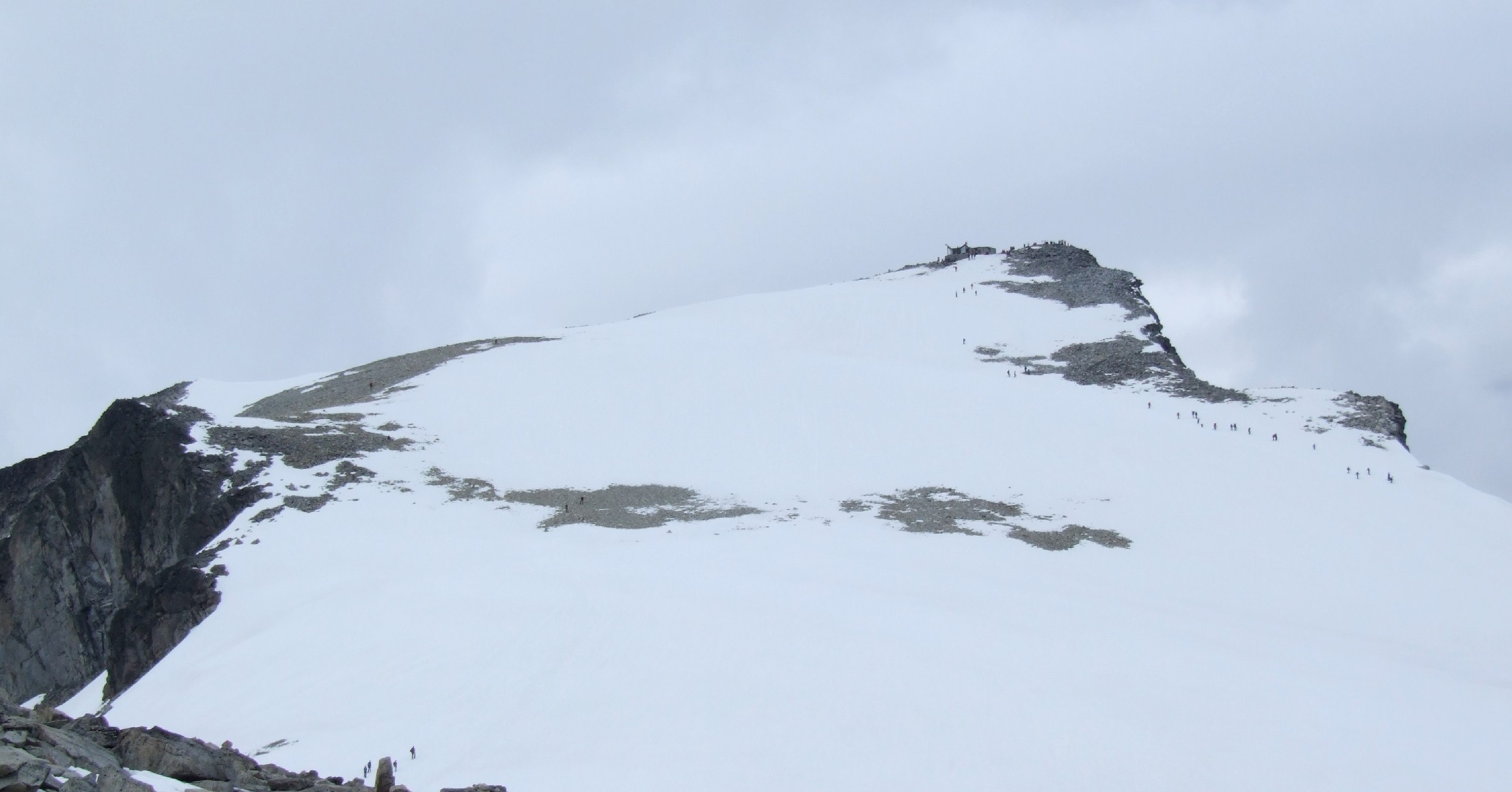
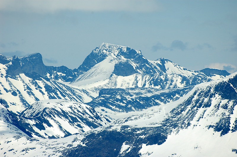
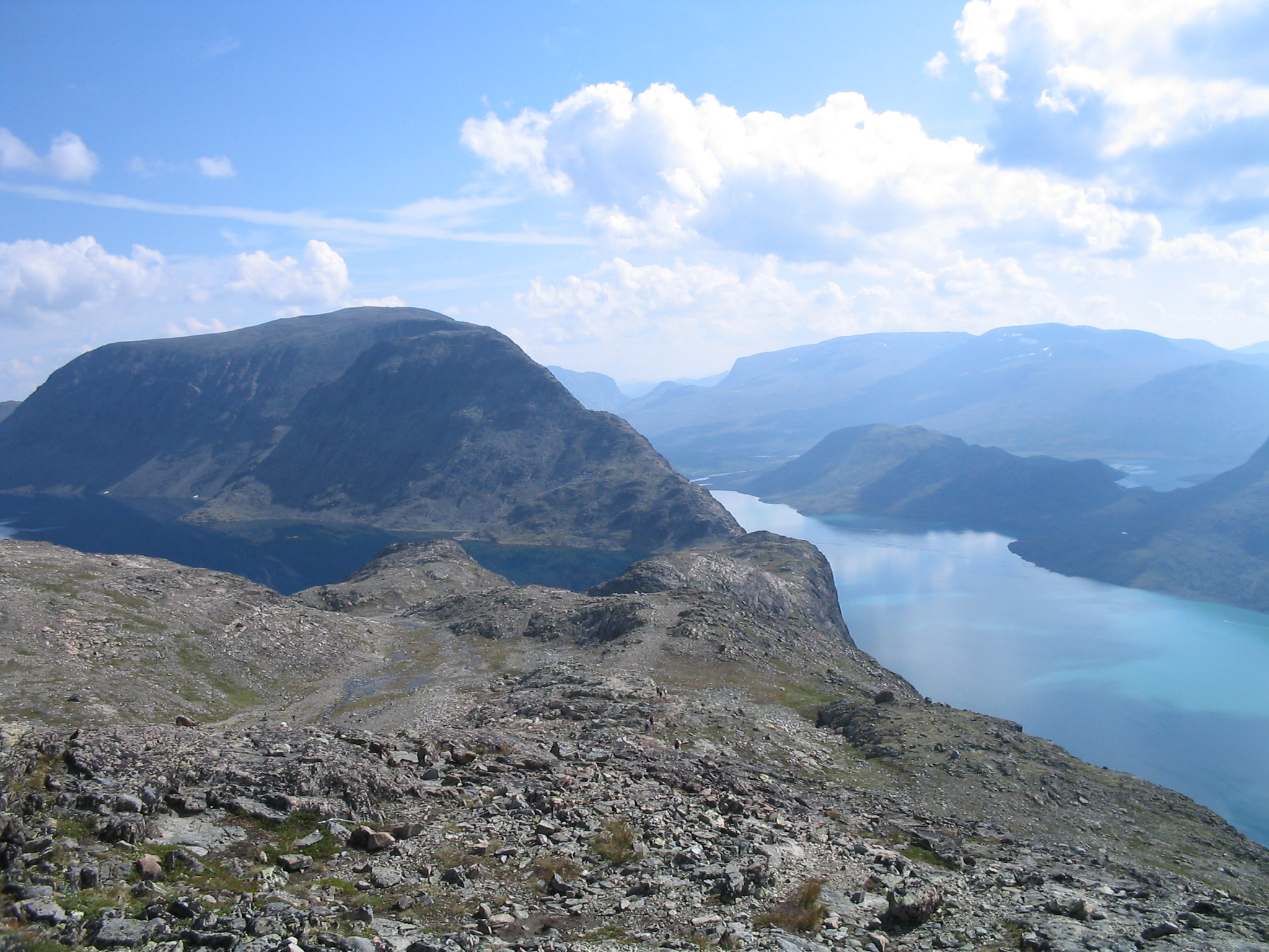
 Jotunhaeimen Massif
Jotunheimen – House (Homeland of Giants) – the massif and Norwegians’ national park
has been the site of hunting since before recorded time. Remains of Stone Age hunting camps have been found near the lakes Gjende and Russvatnet. These remains extend through the bronze and Iron Age, up to recorded times. The high pastures have been used as seters for at least 1000 years.
A “Royal Road” decree from the 15th century required that the residents of Lom must keep the mountain crossing passable to the middle of the Sognefjell, allowing folk from the north Gudbrandsdal access to their trading town of the period, Bergen. Caravans carried farm products down the mountains and returned with salt, iron, cloth and lutefisk.
The name Jotunheimen, or “Home of the Giants” is a relatively recent usage. Aasmund Olavsson Vinje (1818–1879), a famous Norwegian poet and journalist who is remembered for his pioneering use of nynorsk, as well as being an exponent of Norwegian romantic nationalism, coined the term in 1862, adopting it from Keilhau’s “Jotunfjellene” or the mountains of the giants. A memorial was raised in 1909 to Aa. O.Vinje at the western end of Lake Bygdin at his dear Eidsbugarden at today’s outskirts of the national park where he had a private hut. Old friends and followers wanted to commemorate his contribution to appreciation of Norwegian nature and strengthening of the Norwegian national identity.
[the etymology is as intricate as previously. CB]
(English: Galdhø Peak) is the highest mountain in Norway, Scandinavia and Northern Europe, at 2,469 m (8,100 ft) above sea level. It is located within the municipality of Lom, (in Oppland) in the Jotunheimen mountain area.
Galdhøpiggen means “the peak (piggen) of the mountain Galdhø.” The first element in the name of the mountain is gald m “steep mountain road”, the last element is hø f “(big and) rounded mountain.” An old road between Gudbrandsdalen and Sogn passes beneath the mountain.
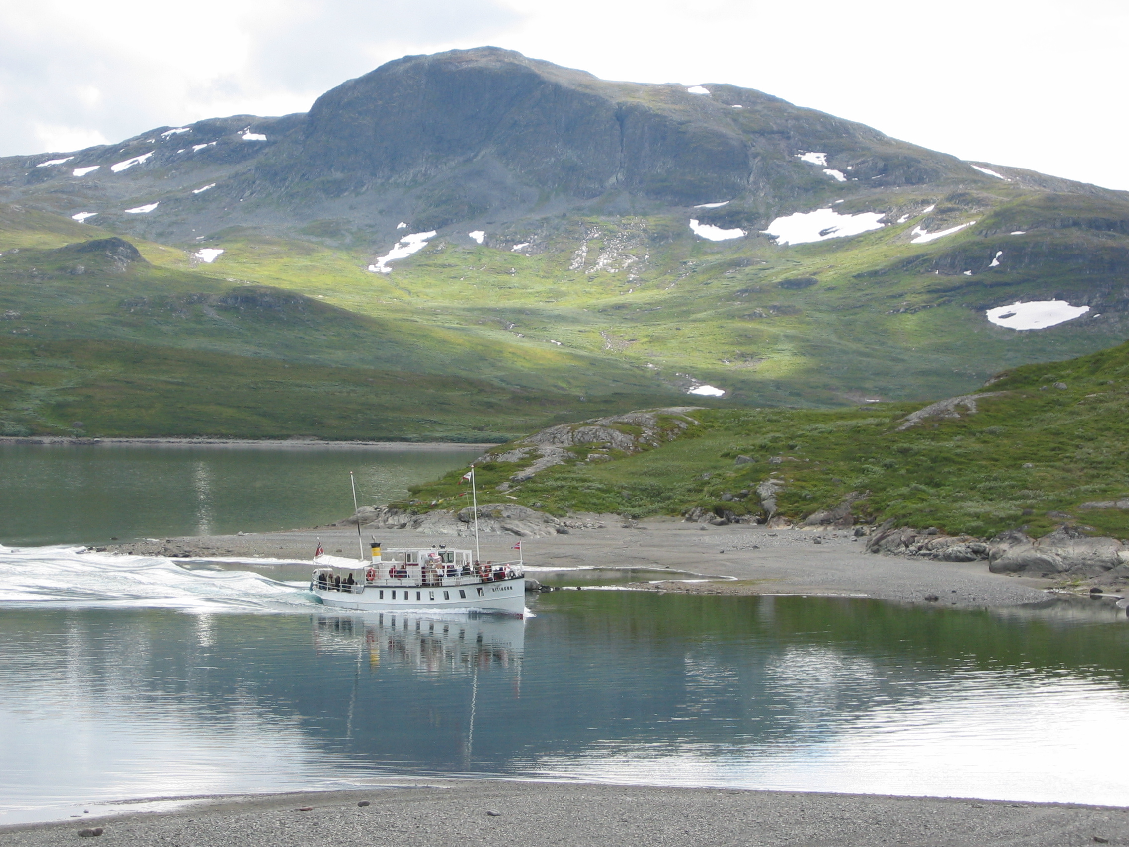
Lake Gjente
Gjende – Lake Grzęda <= roost> (Gendir)
[I do not know if you are convinced by the explanations of German etymology because I am not – considering the previous ones. This lake is ”sitting” on the mountains like a hen on a roost. It is either Grzęda (= roost) or it is Curved / Bent – Lake Zgięte / zgięte = curved, bent/ – Gjente. These are just remains of the Slavic – Old European language which lay at the root of contemporary Scandinavian languages. C.B.]
Gjende (or Gjendin) is a lake in the Jotunheimen mountains in Norway’s Jotunheimen National Park. The proglacial lake shows typical characteristics of glacial formation, being long and narrow—in length 18 km and in breadth 1.5 km at the broadest point with steep walls. Gjende has a characteristic light-green color resulting from the large quantity of rock flour which is discharged into the Gjende by the Muru river. The river Sjoa provides the outlet from Gjende at Gjendesheim, and flows eastward into the Gudbrandsdalslågen river.
Gjende lies in the middle of Jotunheimen National Park and both to the north and south of the lake lie peaks greater than 2,000 m. There are numerous staffed tourist cabins maintained by the Norwegian Mountain Touring Association (DNT); in the west end lies Gjendebu, on the north side lies Memurubu and on the east end lies Gjendesheim. In the summer boats provide transport between these locations.

Name
The name (Old Norse *Gendir) is derived from Norse gandr m ‘staff, stick’. This is referring to the form of the long and narrow lake.
See also Bygdin
Cultural and literary references
Lake Gjende is found in literature and travel books from the 18th century. Together, the Jotunheimen lakes of Gjende and Bygdin play in many such descriptions. For example Henrik Ibsen’s Peer Gynt took his famous wild-reindeer ride along “the Gjendin Ridge”, a reference to either the narrow Besseggen Ridge – or the Knutshø ridge on the other side of lake Gjende.
The official name Gjende is taken from the Gudbrandsdal traditional district dialect used in Lom and Vågå. In the Vang dialect the lake is called Gjendin, which is the form you find in Henrik Ibsen’s name for what is now called Besseggen, formerly Gjendineggen, or Gendineggen in the older orthography. The name Gjende is derived from the old Norse word “gandir” that can be translated into “straight stick”, whereas the lake to the south Bygdin can be translated as “bent stick”, the two names thereby referring to the shape of the lakes.
The lake gave its name to a famous early outdoors man and free thinker, Jo Gjende (1794—1884), who had a cabin at Gjende.
 Brzeg and bugryszcze on Lake Bydgin
Bygdin – Lake Bytów
[The name Bydgin is said by Norwegians to have come from the word bugr –
Do we know this word? Yes, we do – as bagr – bagno (= swamp), as breg– bereh (= coast, lakeside, edge, shore, bank), but also as a top, a swampy hill sacred to Gods – bugryszcze /pronounced: bugryshche/ . C.B.]
is a lake in the Jotunheimen mountain range. Bygdin is regulated and its normal level lies between 1,048 and 1,057 meters above sea level. It has an area of 46 km². The lake is long 25 km, but is narrow. The greatest depth is 215 m.
Bygdin lies to the southeast in Jotunheim and north of the lake lies an area over 2,000 m. Along the lake there are many tourist huts – on the west end lies Eidsbugarden, on the north side lies Torfinnsbu and on the east side lies Bygdin turisthytte. In the summer these huts are connected by boat and in winter by ski or snowmobile. A memorial was raised in 1909 to the Norwegian poet Aasmund Olavsson Vinje at the western end of Lake Bygdin at Eidsbugarden on the outskirts of Jotunheim National Park where he had a private hut. Friends and followers commemorated his contribution to appreciation of Norwegian nature and strengthening of the Norwegian national identity. Today Eidsbugarden is a rather large mountain tourist centre, with a hotel from 1909 which is being restored to reopen in the summer 2007, a Norwegian Mountain Touring Association (DNT) cabin and approximately 160 private huts.
The Vinsteråni river runs out Bygdin, passes through Vinstervatna and Vinstra lakes and flows into the Gudbrandsdalslågen river.
Name
The name (Old Norse *Bygðir) is derived from Norse bugr m ‘bending, nook, bay’. This is referring to the “bent” form of the lake.

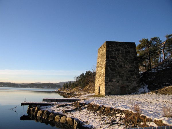
The Panorama of Amageru with Dragor town, here the panorama [CLICK] from hilla Kalve. Is it again a would-be Catholic kalwaria?
If you lengthen The Arkona – The Pyramid of Cheops Line to the north you will unexpectedly find the coast of Denmark. This line will go through Amager Isle and a coastal village – the town of Dragor today and next it will go through Kopenhagen which the Czechs still call familiarly – Kodeń.
Dragør
Dragør is a picturesque Danish town situated on Amager Island on the Sund strait. This fishing settlement was the hub of trade in Baltic herring in the Middle Ages. However, it did not have a harbour so boats were taken to the coast and the name of the place derives from a sandy piece of land. Every summer, thousands of tourists stroll on cobbled streets of Dragør and enjoy the sight of little yellow houses decorated with flowers as well as the bridge joining Denmark with Sweden.
[Here is how the Danes explain the name of the town, but we surely know that draga is a trawl boat (łódź = boat; włoka = trawl) which is trawled along a shallow bottom of a fishing net that is just being pulled onto the coast and dragged along swampy banks, like on the Prypeć (Pripyat) River – it is being dragged (= dragowana) – pulled to another river on which it can sail farther. Hence, the tribe living on the swamps Dregowicze /pronounced: dregovyche/ and the name of the swamp – Draga. And interestingly, the name Dragor can also be associated with the fiery dragon – Ardent Drak (= Gorejący Drak).
Till today, the Czechs have been using the familiar name Kodeń for Kopenhagen. The Slavs called this settlement Kodeń in the distant past. We are familiar with other Slavic Ku-Dans (Ku-Dany) because Dana-Dawana simply means Dażboga – Heavenly Godess (Pani Niebieska; niebieska = blue) – and at the seaside blue water joins the blue sky into one great Heavenly blue – lightness. The other Kodeń – Gdańsk – Ku-Dańsk is the same as K-Dynia-Gdynia. What is more, we know Kodeń lubelski (Kodeń near Lublin) – today a village but in the past a settlement famous for the worship of Dana-Dawana-Dażboga-Daćboga Heavenly Godess (Heavenly Godess = Pani Niebieska; niebieska = blue) = God’s Mother of Kodeń. The Danish Kodeń along with Slavs and Scyths merges something more – the character of the legendary coat of arms Mermaid
(= Syrena) known from Mazovia and the Capital City of Poland – Warsaw (= Warszawa), but the Mazovian-Mazian Mermaid, as befits the Amazonka, is armed C.B.]
 The photo presents Polish Kodeń
However, let us go on to other elements of this line. Through Jasna Góra (Luminous Mount) and Wawel /pronounced: vavel/, and farther to the Moravian Gate, the northern lines of Arkona – Ślęża merge into the Polish System – with Łysa Góra (Bald Mountain) and its Temple of Nine Circles.
Łysa Góra (Bald Mountain) – The Complex of the Temple of Nine Circles
This map is very serious for it presents the Temple of Nine Circles – Łysa Góra (Bald Mountain) and eight mountains compounded in it. Each of them is sacred not to a single god only, but to the Place of Deities – the place surrounded by walls. It is sacred to Nine Divine Places on Nine Mountains and also to Nine Circles and Nine Tribes of the SIS Kingdom (of Scolots-Istiowie /pronounced: istyovye/-Slavic, Sistan). But it is not enough as there are not THREE but THREE multiplied by THREE sacrifices which makes Nine so Nine of Nines are encoded, Nine to the power of Nine – simply the top of tops – what can be closed in one word: Dewa-Dew /deva, dev/(Bóg – Bóg Bogów = God – the God of Gods). We will tell about the Nine nines in Lesson 9. To clarify, we will only say that the Three of Nines mentioned above is the Three of Jawia /yavya/ – the Earth of the visibale world.
The Three of Nawia /pronounced: navya/ – the Afterlife – is as follows: Nine Gates of Sowi to the Afterlife, Nine Pilgrimage Trails Lelija through Nawias and Nine as the magic symbol of the number of Death and of the End – the Highest.
The Three of Prawia /pronounced: pravya/ is: The Ninth Highest Incarnation =
the God of Gods (1×9), Nine Fires on Równia /ruvnya/ (równia = level, plane)
and Nine Monsters from which all that is alive was created (2×9) as well as 27 Gods that are worshipped in the Nine Circles (27 = 3×9).
At this point we will cite the Book of Rue – Mystery 19 with an annotation to it:
“…Eight is the Number of Completeness. Nine is the Number of the End. One is the Number of Renewal and Unity.
There are Eight Circles on Wela /pronounced: vela/ and the last of them is the Circle of Stworza /stwoʒa/. But each of the Circles of Life, or Wela, Earth, or Heaven overlaps the circles of the other world as if it was absorbing the highest of its circles. The highest Temple of the Faith of Nature is the Temple of Nine Circles because there are eight circles in the world of a given level and the one which is hidden, raised and rising from the lowest level towards the higher worlds. The one that is pulled in and that moves towards the top gives motion to everything, is the source of renewal and endless life of the worlds. This circle is also the source of the unity of the whole World, its bond…
♦
…The first of the peoples in the Sis kingdom – Lęgowie /pronounced: lewgovye/ made sacrifices to Veleses (Nawias /navyas/), in particular to their tribal patrons – Veles and Nyja /nyia/.
The second of the tribes of the Sis kingdom – Budini feted in the holy place of Świstowie /shvystovye/ – they feted especially Strzybog and Stryja /stʒibog; stryia/. The Budini did not make offerings to one god only – Poświst /poshvist/ – the Deity of Mild Breezes. Kings of this tribe regarded themselves as Strzybog’s grandchildren and they were usually called so.
The third tribe of the Sis kingdom – Wędowie /pronounced: vewdovye/ worshipped Źrzeby / Żrzeby /ʒiʒeby, ʒʒeby/(which means enlivened), particularly Makosz /makosh/ and Mokosz /mokosh/ in the Temple of Nine Circles. The Wędowie continually migrated and Żrzebowie as well as Weniowie /venyovye/ were the gods especially important for trophy journeys. They were particularly helpful during sea journeys as Guardians of Fate Judgement.
The forth tribe – Istowie-Jątowie /pronounced: istovye, yowtovye/, worshipped Sołów /sowuv/ most of all, mainly Zorza /zoʒa/and Daboga-Dobra as their patronesses. Zorza (= aurora) had a special significance in the Faith of Nature of all the Istowie while Znicz Sołów in Szwintorog was the most popular place of pilgrimages to the land of Istowie. Pilgrims from the whole Sis kingdom travelled there.
The fifth tribe – Nurowie /prounced: nurovye/ made sacrifices to Runy as well as to their main guardians Perun and Łysek /wysek/. Hereof, later on Strzybog and Perun were worshipped most all over Nurusja /nurusya/ formed by united Nurowie and Budini.
Burowie /pronounced: burovye/, the sixth tribe of the Sis kingdom glorified Simowie /symovye/, particularly Sim and Skalnik. The Burowie were always srongly attached to the Stone Mountains – Ural, to mining and iron smelting, to the Volga-Rzwa River and the Black Land as well as Black Island (Kara Island).
The seventh tribe of the Sis Kingdom – Skołoci /pronounced: skowotsy/ paid homage to Ubożowie /uboʒovye/, mainly to Bożebogow /boʒebogov/ and Boda, especially in the later times when they set up the Bogotroja /bogotroya/ settlement in Bogtoharia where Bożebóg /boʒebug/ was extolled from among the whole Group of SIS Gods. Finally, Bożebóg became the main god in a dissenting Zarathustrian faith proselytised by Żar-zdusz (Żarduszt) which resulted in Skolots’ breaking off bonds with Miodewowie /myodevovye/ and Persians as well as a long continuation of wars which brought on endless hostility of those nations.
Serbomazowie /pronounced: serbomazovye/, the eigth tribe of the Sis Kingdom, mainly Mazonie /mazonye/ and Mazonki generally worshipped Łady /wady/, mostly Łada-Łagoda and Ładziwa /wadʒyva/with whom they associated the character of Łęda-Łabęda /wewda; wabewda/, the patroness of Lądud /lowdud/. The female Mazons particularly honoured Dziewanna /dʒyevanna/, which kept the tribes of Serbomazowie /serbomazovye/ and Dachowie-Dawowie /dahovye, davovye/ closer to each other.
The ninth tribe of the Sis Kingdom were Dawowie-Dachowie who made sacrifies to Dziewowie /dʒyevovye/and pleaded for their grace. Among the gods, Dawowie-Dachowie especially worshipped Kupała-Dziwienia /kupawa, dʒyvyenya/ and Dziewanna.
As it can be perceived, 20 gods have been specified. From among 9 divine places seven have not been mentioned. Nonetheless, they are written about much later – in the Book of Tany – Mystery 27 [which means number 9].
The Complex of Łyskogórskie Royal Graves – Pełczyska, Słonowice – Góra Pełke (Mount Pełke)
The Welski Complex– Kraków


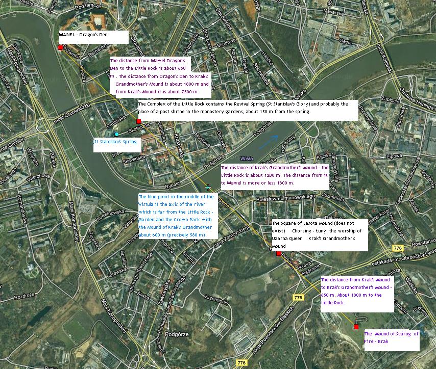
Here is the completely accidental Line of Krak – Wawel Dragon’s Den at almost accurate intervals of 600-650 metres between significant points. As for such a short distance as 2,4-2,5 kilometres accuracy up to 50 metres, as here, is measurable and attainable using steps – but one must overcome terrain obstacles like a river and quite big area slopes. On Wawel stood a mound – I understand it was the Welski Mound imitating Mount Skon, i.e. the Mount Welska that both Lithuanians and Rusyns knew perfectly in their records and that became Glassy Mountain (Szklana Góra) in legends and fairy tales after introducing Christianity. At its entrance lived a dragon, Guard-Drak. The Lithuanians called the dragon Wizunas. Drakowie /pronounced: drakovye/ are Trakowie – Krakowie /krakovye/, Trakowie /trakovye/– Thracians, Dragon and Viper-Snake Warriors, the Guards of Royal Graves – Czaropanowie /charopanovye/ (Karopanowie /karopanovye/). Well, the Dragon is the symbolic guard at the gates of the Cave leading to the Afterlife (cave = jaskinia) – at the gates of Jaskinia – Jaseł-Skonu (Jas-Końca) /pronounced: yasew skonu; jas konitsa/. It must be an ancient initiation place like the one from Ojców Valley with its cave. In addition, the exit from the system of the caves (today walled and limited just to one cave) which is entered from the top is usually down – at the mountain but if water is high, it lies under the water. The intervals are 650-600- 600-650. It is a very intriguing occurence, isn’t it?
I would even say that it can not be an occurence by any chance. Well, let us add that the Line goes through Esterka’s Mound, through the Holy Grove Tonie (Tonie = Duna like in dunaj /pronounced: dunay/) and through the Dog Rock in Jerzmanowice to Jasna Góra (Luminous Mount), and farther on to Lech’s Mount, next to Chełm in Koszalin and farther through Iwo Island and the Morowa /morova/ River, then through Ostoya, Bronnoya, Nesoya, Boroya, Gaesoya as well as Grimoya to the Massif of Giants beyond Oslo – where it ends the known world, the place from which one can see the Seventh or Three-Ninth Sea – the Afterlife with their Northern Lights.
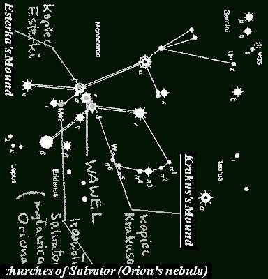
The Complex of Ojców Valley and of the Valley of Bytów Spring – Sirius,Orion, Dog Rocks
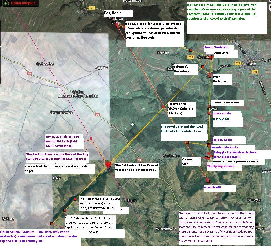
You know this map very well from the article about Ojców Valley which I recommend to you so that you get to know the details, but there is a lot of information here in the description.
[Available picture files in the article are licensed by Creative Commons Acknowledgement of authorship – on the same conditions 3.0 niezlokalizowana]
[to be continued – soon]
Tags:Scyths, Slavs, Vikings